Finding the azimuth between two points is a fundamental skill in navigation, surveying, and geospatial analysis. The azimuth represents the angle measured clockwise from a reference direction, typically true north, to the line connecting two locations. Calculating the azimuth is crucial for accurate mapping, determining direction, and planning routes, whether for hiking, maritime navigation, or engineering projects. Understanding how to compute azimuth helps professionals and enthusiasts alike make precise measurements and improve spatial awareness.
Understanding Azimuth
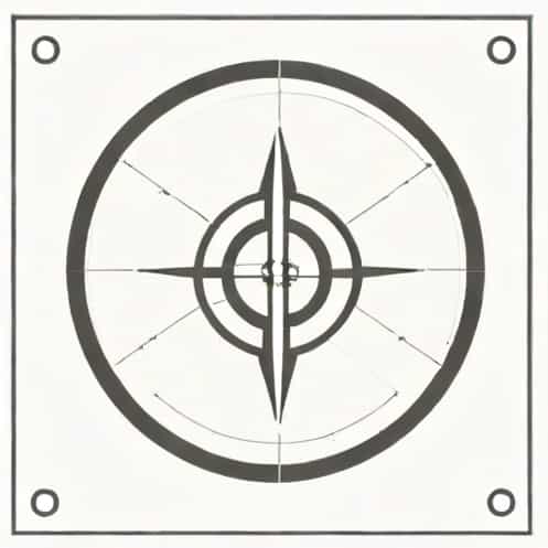
An azimuth is the angular measurement in degrees between the north direction and the line connecting two points on the earth’s surface. It is usually expressed in a range from 0° to 360°, where 0° represents true north, 90° represents east, 180° south, and 270° west. Azimuths can be categorized into true azimuths, which are based on geographic north, and magnetic azimuths, which are based on magnetic north as indicated by a compass.
Applications of Azimuth
The azimuth has multiple applications across various fields
- NavigationMariners, pilots, and hikers use azimuths to determine direction and chart courses.
- SurveyingSurveyors calculate azimuths to establish property boundaries and construction layouts.
- Geospatial AnalysisIn GIS (Geographic Information Systems), azimuths help in modeling spatial relationships and orientation of features.
- Military and DefenseAzimuths are essential for targeting, positioning, and reconnaissance.
Methods to Find Azimuth Between Two Points
There are several methods to determine the azimuth between two points, ranging from traditional techniques to modern computational approaches. The choice of method depends on the available tools, required precision, and the context of the application.
Using a Compass and Map
This is one of the simplest methods for finding an azimuth in the field. The process involves
- Placing a map on a flat surface and locating both points.
- Aligning a ruler or straightedge between the two points.
- Using a compass to measure the angle between the north direction on the map and the line connecting the points.
- Reading the azimuth in degrees clockwise from north.
This method provides a quick estimate but may have limitations in precision due to map scale and human error.
Using Trigonometric Calculations
Azimuth can also be calculated mathematically using the coordinates of two points. The formula for azimuth between two points with known latitudes and longitudes is derived from spherical trigonometry
Azimuth (θ) = atan2(sin(Îλ) * cos(Ï2), cos(Ï1) * sin(Ï2) â sin(Ï1) * cos(Ï2) * cos(Îλ))
- Ï1 and Ï2 are the latitudes of the first and second points in radians.
- Îλ is the difference in longitudes between the two points in radians.
- atan2 is a variant of the arctangent function that considers the signs of both arguments to determine the correct quadrant of the angle.
This method provides high accuracy and is commonly used in geodesy, GPS navigation, and GIS applications. The resulting azimuth can be converted from radians to degrees for practical use.
Using GPS Devices
Modern GPS devices and smartphone applications can automatically calculate azimuth between two points. By inputting the coordinates of the start and end points, the device computes the azimuth using internal algorithms. This method is highly convenient and reduces the chance of human error, making it ideal for fieldwork and quick navigation decisions.
Using Geographic Information Systems (GIS)
In GIS software, finding azimuth between two points is straightforward. Most GIS platforms allow users to select two features and automatically calculate the azimuth. This approach is particularly useful for large-scale mapping projects, spatial analysis, and professional surveying tasks. GIS tools can also account for projection distortions and provide more precise results over long distances.
Factors Affecting Azimuth Accuracy
Several factors can influence the accuracy of azimuth calculations
- Earth’s CurvatureOver long distances, the curvature of the earth must be considered to avoid errors.
- Map ProjectionsDistortions in different map projections can affect azimuth readings.
- Magnetic DeclinationIf using a compass, the difference between true north and magnetic north must be accounted for.
- Measurement PrecisionHuman error, instrument resolution, and environmental factors can impact results.
Practical Tips for Finding Azimuth
For those seeking accurate azimuth measurements, consider the following tips
- Always use reliable coordinates or maps to reduce errors.
- Double-check calculations or measurements using multiple methods.
- Account for magnetic declination when using a compass.
- Use digital tools like GPS or GIS software for complex or long-distance azimuth calculations.
- Understand the context of the azimuth, whether true or magnetic, for accurate navigation.
Finding the azimuth between two points is an essential skill for navigation, surveying, and geospatial work. Whether using a traditional compass, mathematical formulas, GPS devices, or GIS software, understanding how to calculate and interpret azimuth ensures accurate orientation and effective decision-making. By considering factors such as earth curvature, magnetic declination, and measurement precision, users can achieve reliable results. Mastering azimuth calculations not only improves technical proficiency but also enhances safety and efficiency in fieldwork and everyday navigation.