A map of the Western Hemisphere offers a unique perspective on the world, allowing viewers to focus on the Americas, the Atlantic Ocean, and portions of surrounding regions that shape global interactions. Many people use this type of map to understand geography, climate, exploration routes, cultural connections, and historical development. Because the Western Hemisphere features both densely populated nations and vast stretches of wilderness, studying it gives a balanced picture of human activity and natural landscapes. Whether for learning, travel planning, or curiosity, exploring the Western Hemisphere helps people appreciate how continents, oceans, and cultures interconnect.
What the Western Hemisphere Includes
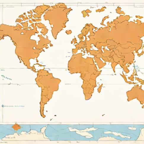
The Western Hemisphere is typically defined as the half of the Earth lying west of the Prime Meridian and east of the 180° meridian. While boundaries are based on longitudes, the cultural and geographic interpretation focuses mainly on the Americas and the surrounding oceans. Looking at a map of the Western Hemisphere highlights how countries are arranged and how their coastlines interact with larger water bodies.
The Americas as the Core
The Americas dominate the Western Hemisphere. North America, Central America, South America, and the Caribbean form the central landmass visible on most hemispheric maps. These regions include every type of climate zone, from Arctic tundra to tropical rainforests, making the hemisphere one of the most diverse on the planet.
Oceans Surrounding the Hemisphere
A map of the Western Hemisphere places great emphasis on oceans. The Atlantic Ocean stretches between the Americas, Europe, and Africa, while the Pacific touches the western coastlines of North and South America. Although the Pacific is often associated with the Eastern Hemisphere, a significant portion of it lies within the Western Hemisphere as well.
Geographic Features Highlighted on a Western Hemisphere Map
Because a hemispheric map zooms out, viewers see major natural formations that influence climate, migration, and development. Understanding these features provides context for how civilizations formed and how transportation routes emerged over time.
Major Mountain Ranges
- The Andes MountainsStretching along the western edge of South America, this is the longest continental mountain range in the world.
- The Rocky MountainsExtending from Canada to the southwestern United States, this range shapes weather patterns and habitats.
- The Appalachian MountainsOne of the oldest mountain systems in North America, found in the eastern region.
These ranges are easily identifiable on most hemispheric maps because they create distinct outlines and elevations across the continents.
Notable Rivers and Lakes
Large rivers such as the Amazon, Mississippi, and Rio Grande often stand out on maps of the Western Hemisphere. The Amazon Basin, for example, dominates the northern region of South America and influences global biodiversity. The Great Lakes of North America, situated between the United States and Canada, are also prominent features often highlighted on hemisphere maps.
How Hemispheric Maps Represent Continents and Regions
Unlike traditional world maps, a map of the Western Hemisphere centers on the Americas, shifting Europe, Africa, Asia, and Oceania toward the edges or out of view entirely. This creates a different perspective, emphasizing relationships that are sometimes minimized in world map projections.
A Focus on North America
North America is often the largest and most detailed landmass on a Western Hemisphere map. It includes Canada, the United States, Mexico, and Greenland. The Arctic region also appears prominently at the top of the hemisphere, helping viewers visualize how northern climates connect across longitudes.
The Position of South America
South America typically appears slightly right of center on hemispheric maps. Its slender shape contrasts sharply with the broader shape of North America. Major cities, rainforests, deserts, and mountains all fall within easy viewing range. The continent’s position also shows how it connects to other regions through ocean trade routes.
The Caribbean and Central America
Although smaller in size, these regions hold strategic and cultural importance. A map of the Western Hemisphere places them near the center, emphasizing their historic roles in exploration, migration, and trade.
The Importance of Studying the Western Hemisphere
Understanding this hemisphere helps explain global history, travel routes, climate relationships, and modern political interactions. Because the map highlights both land and water, it offers a balanced overview of human and environmental dynamics.
Historical Exploration
For centuries, the Western Hemisphere played a major role in exploration and colonization. Maps were essential tools for explorers navigating the Atlantic Ocean. Today, looking at hemispheric maps helps people see the scale of voyages connecting Europe, Africa, and the Americas.
Climate and Weather Patterns
The Western Hemisphere contains some of the most diverse climate zones on Earth. Studying maps helps explain how ocean currents, mountains, and latitudinal differences create weather variations across regions.
Differences Between Hemispheric Maps and World Maps
While a world map tries to show everything at once, a hemispheric map focuses on half of the planet, allowing more detail. This perspective changes how viewers interpret relationships between continents and oceans.
Reduced Distortion
Many hemispheric maps, especially globe-based ones, reduce the distortion seen in flat maps. Landmasses appear more proportional, making it easier to compare relative sizes.
Clear Emphasis on the Americas
Because the hemisphere centers on the Americas, viewers immediately understand the shape and orientation of North and South America without distractions from regions across the world.
Educational Uses for a Western Hemisphere Map
Maps of the Western Hemisphere serve multiple purposes in classrooms, research, and travel planning. They help learners visualize connections between geography and culture while also supporting a range of academic subjects.
Geography and Earth Science
Students can use hemispheric maps to study tectonic plates, mountain ranges, rivers, climate zones, and ecosystems. This type of map simplifies the focus on the Americas while still showing relevant oceanic features.
History and Cultural Studies
From Indigenous civilizations to colonial expansion, many historical events unfolded across the Western Hemisphere. A focused map helps observers trace these movements over time.
Travel and Navigation
Travelers often use hemispheric maps to understand distances between continents or to visualize cruise routes, flight paths, and ocean crossings. This perspective helps highlight how close certain countries are by air or sea, even if they seem far apart on traditional maps.
Modern Uses of Western Hemisphere Maps
In today’s world, maps remain essential tools for communication, research, and planning. A hemispheric map remains relevant due to its clarity and wide range of uses.
Environmental Research
Scientists use hemispheric maps to monitor climate change, deforestation, ocean temperatures, and migration patterns of wildlife. The map’s scale makes it easier to track large environmental shifts.
Political and Economic Analysis
Governments and organizations analyze hemispheric maps to understand regional trade routes, geographic advantages, and diplomatic relationships. The Western Hemisphere’s position influences global economics and cultural exchange.
A map of the Western Hemisphere provides an informative and visually organized way to study the Americas and surrounding oceans. It highlights major geographic features, cultural regions, and historical connections that shape the modern world. Whether used for education, travel, or personal interest, this perspective offers a deeper understanding of how continents and oceans interact. Exploring the Western Hemisphere through maps encourages curiosity, supports learning, and reveals the remarkable diversity found across half of our planet.