Bangui, the capital city of the Central African Republic, is a prominent urban center with both historical and geopolitical significance. Located in the heart of Africa, it serves as the administrative, economic, and cultural hub of the country. Understanding where Bangui is on the map provides context for its role in regional trade, politics, and transportation. The city’s strategic location along the banks of the Ubangi River has shaped its development, linking it to neighboring countries and facilitating commerce and communication. For travelers, researchers, and anyone interested in African geography, identifying Bangui on a map is crucial for understanding the dynamics of Central Africa.
Geographical Location of Bangui
Bangui is situated in the southwestern part of the Central African Republic, near the border with the Democratic Republic of the Congo. Geographically, the city lies on the northern banks of the Ubangi River, which serves as a natural boundary and a major waterway connecting it to the Congo River system. The city’s coordinates are approximately 4.36 degrees North latitude and 18.55 degrees East longitude, placing it within the tropical climate zone. This location impacts both the city’s weather patterns and its agricultural and trade activities, as the Ubangi River provides fertile floodplains and transportation routes.
Significance of the Ubangi River
The Ubangi River is a vital feature of Bangui’s geography. Flowing along the city’s southern edge, it links Bangui to other major African waterways and neighboring countries. Historically, the river facilitated trade, allowing goods such as coffee, cotton, and timber to move efficiently. Even today, the Ubangi River remains important for transport and local commerce, connecting Bangui to regions downstream in the Democratic Republic of the Congo. Its presence has also influenced urban planning, with key districts and infrastructure located along its banks to take advantage of river access.
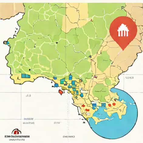
Bangui on the Map of Central Africa
When looking at a map of Central Africa, Bangui stands out as the southern gateway of the Central African Republic. The country itself is landlocked, bordered by Chad to the north, Sudan and South Sudan to the east, the Democratic Republic of the Congo and the Republic of the Congo to the south, and Cameroon to the west. Within this context, Bangui’s position in the southwest makes it the closest major city to the country’s borders with the Democratic Republic of the Congo and the Republic of the Congo, enhancing its importance for cross-border relations and trade.
Transport and Connectivity
Bangui’s location on the map is not just significant for geography but also for transport and connectivity. The city is served by M’Poko International Airport, which provides air links to other African capitals and international destinations. Roads and highways connect Bangui to other major cities in the Central African Republic, although infrastructure can be limited due to the country’s landlocked nature and challenging terrain. The river and overland routes collectively enhance Bangui’s strategic importance, allowing it to function as a hub for trade, humanitarian aid, and administrative activities.
Urban Layout and Districts
Understanding where Bangui is on the map also involves recognizing its internal geography. The city is divided into several districts, each with specific functions
- Central DistrictHome to government offices, the presidential palace, and major administrative buildings.
- Pierre Savorgnan de Brazza DistrictA residential and commercial area with markets and local businesses.
- Gbanikola and PK5 DistrictsKnown for bustling trade centers, cultural landmarks, and community hubs.
- Along the Ubangi RiverRiverside areas feature ports, small harbors, and transport infrastructure crucial for trade.
These districts highlight how Bangui’s position on the map influences urban planning and resource distribution.
Historical and Political Context
Bangui’s location has historical significance as well. Founded in the late 19th century during the colonial period, the city grew as a trading post along the Ubangi River. Its position on the map allowed colonial powers to control river traffic and regional trade. Over time, Bangui became the capital of the Central African Republic upon independence in 1960. Its proximity to neighboring countries continues to influence political relations, security considerations, and economic partnerships in the region.
Role in Regional Diplomacy
Bangui’s location near international borders has made it a focal point for diplomacy and regional cooperation. It hosts embassies, consulates, and international organizations that manage relations with neighboring states. Being on the map at this strategic juncture allows the city to play a central role in initiatives related to trade agreements, peacekeeping efforts, and cross-border humanitarian aid.
Climatic Influence of Location
Bangui’s geographic coordinates contribute to its tropical climate, characterized by a wet season from May to October and a dry season from November to April. The city’s location near the equator ensures relatively high temperatures throughout the year, with the Ubangi River moderating some local climatic effects. This climate influences agricultural activities, urban infrastructure planning, and daily life in the city, making its location an important factor for both natural and human systems.
Agricultural and Economic Impact
Being situated along the Ubangi River and in fertile southwestern Central African Republic, Bangui supports agricultural activities both within and outside city limits. Crops such as cassava, maize, and coffee are grown in surrounding areas and transported into the city for trade and consumption. Bangui’s location enables it to function as a commercial hub where goods from rural areas are collected, processed, and distributed, highlighting the interplay between geography and economic activity.
Bangui in Maps National and Global Perspective
On a national map, Bangui is easily identifiable in the southwestern part of the Central African Republic along the Ubangi River. It is often marked prominently due to its status as the capital. On a continental or global map, Bangui appears in central Africa, emphasizing the country’s landlocked position and highlighting its connections to major African rivers and neighboring states. Maps showing trade routes, rivers, and transportation infrastructure often emphasize Bangui’s strategic location for logistics and administration.
Tourism and Landmarks
Bangui’s location also shapes its tourism appeal. Visitors can explore the scenic Ubangi River, historical colonial architecture, and cultural markets that reflect the city’s unique identity. Key landmarks, such as the Boganda National Museum and the Presidential Palace, are situated in central districts that are easily accessible from river ports and main roads, demonstrating how geographic location supports cultural and recreational activities.
Bangui, located on the banks of the Ubangi River in the southwestern part of the Central African Republic, holds both geographical and strategic importance. Its position on the map influences urban planning, transport, trade, and political relationships with neighboring countries. The city’s districts, river access, and climate reflect the practical implications of its location, shaping the lives of residents and the functioning of the capital. By understanding where Bangui is on the map, one gains insight into the Central African Republic’s geography, economy, and role in regional affairs. The city’s location not only defines its present significance but also provides context for historical development, cultural identity, and future potential as a central hub in central Africa.