Groundwater is one of the most important sources of fresh water on Earth, providing drinking water, irrigation for agriculture, and support for ecosystems. Beneath the soil and rocks, water fills tiny spaces and cracks, forming underground reservoirs that humans and nature rely on. To better understand how groundwater works, it is essential to know its structure and identify the top layer of groundwater, which plays a critical role in hydrology, water supply, and environmental balance.
The Basic Structure of Groundwater
Groundwater does not exist as underground lakes or rivers in most cases. Instead, it is stored in the pores and fractures of soil, sand, gravel, and rock. These underground formations that hold and transmit water are called aquifers. However, before groundwater accumulates deeper in aquifers, it first forms at the top level of saturation, creating what is known as the water table.
The Top Layer of Groundwater The Water Table
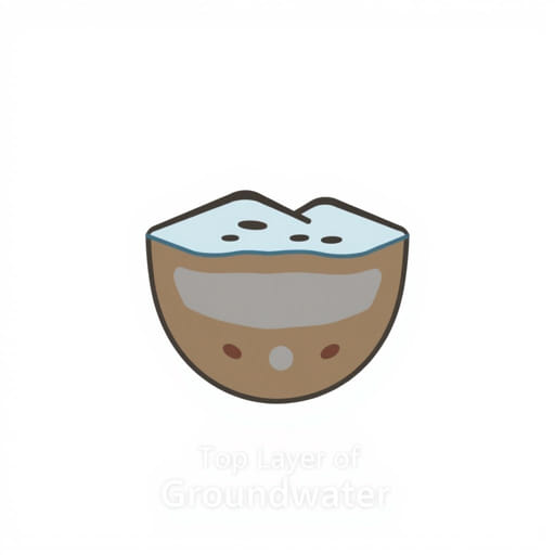
The water table is considered the top layer of groundwater. It marks the boundary between the unsaturated zone above and the saturated zone below. In the unsaturated zone, also called the vadose zone, soil and rocks contain both air and water, but they are not completely filled with water. The saturated zone, on the other hand, is where all the pores and cracks are filled with water. The top of this saturated zone is the water table, making it the uppermost layer of groundwater.
Key Features of the Water Table
- Boundary LineIt separates the unsaturated zone from the saturated zone.
- Dynamic LevelThe water table can rise or fall depending on rainfall, drought, or human water usage.
- Direct ConnectionIt is influenced by surface water such as rivers, lakes, and precipitation.
- Indicator of AvailabilityThe depth of the water table often determines how easy it is to access groundwater.
The Unsaturated and Saturated Zones
To understand why the water table is considered the top layer of groundwater, it is useful to look at the zones around it. Above the water table is the unsaturated zone, where plant roots can access moisture but the soil still contains air. Below the water table is the saturated zone, where all voids in soil or rock are completely filled with water. This is where groundwater truly exists in large volumes.
The Capillary Fringe
Just above the water table, there is a thin layer called the capillary fringe. In this layer, water is pulled upward by capillary action into the spaces of soil and rock above the saturated zone. Although technically part of the unsaturated zone, the capillary fringe often behaves like an extension of the water table and is important for plant growth and soil moisture.
How the Water Table Changes
The water table is not a fixed boundary. It shifts based on natural and human factors. During heavy rainfall or snowmelt, the water table tends to rise as more water infiltrates into the ground. During drought or heavy pumping from wells, the water table may decline, sometimes drastically.
Factors Affecting the Water Table
- ClimateRegions with high rainfall usually have shallow water tables, while arid regions may have very deep ones.
- Seasonal VariationIn wet seasons, the water table rises; in dry seasons, it falls.
- TopographyThe water table often follows the shape of the land, being higher under hills and lower in valleys.
- Human UseExcessive pumping for agriculture, industry, or drinking water can lower the water table.
Why the Water Table Matters
Recognizing the water table as the top layer of groundwater is vital because it determines the accessibility and sustainability of water resources. Farmers, engineers, and environmental scientists rely on accurate knowledge of the water table to plan irrigation, construct wells, and protect natural habitats.
Practical Importance
- Drinking WaterMany wells tap into water near the water table to supply homes and communities.
- AgricultureCrops depend on shallow groundwater and soil moisture, especially in regions with limited rainfall.
- ConstructionBuilders must account for the depth of the water table when planning foundations, basements, and infrastructure.
- EcologyWetlands and rivers often depend on the interaction between surface water and the water table.
Groundwater Recharge and Discharge
The water table is constantly changing because of recharge and discharge processes. Recharge occurs when precipitation, rivers, or melting snow seep into the ground and replenish the aquifer. Discharge happens when groundwater flows into rivers, lakes, or springs, or when it is pumped out by humans. The balance between recharge and discharge determines the stability of the water table.
Threats to the Water Table
The health of groundwater depends on protecting the water table. Several challenges threaten its stability and quality.
Over-Extraction
When too much groundwater is pumped for irrigation or urban use, the water table can drop significantly. This leads to problems such as dry wells, land subsidence, and reduced river flow.
Pollution
The water table can be contaminated by pollutants from fertilizers, pesticides, industrial chemicals, or leaking septic systems. Because groundwater moves slowly, contamination is difficult and costly to clean.
Climate Change
Changes in rainfall patterns and rising temperatures affect groundwater recharge. Prolonged droughts lower the water table, while extreme storms may cause sudden fluctuations.
How to Protect the Water Table
Since the water table is the top layer of groundwater and essential for life, protecting it is a shared responsibility. Several strategies can help maintain healthy groundwater resources.
- Water ConservationUsing water wisely reduces the pressure on groundwater supplies.
- Recharge EnhancementPractices like rainwater harvesting and artificial recharge basins help replenish groundwater.
- Pollution PreventionReducing the use of harmful chemicals and ensuring safe waste disposal protects groundwater quality.
- MonitoringTracking groundwater levels and quality helps detect problems early and guide management decisions.
Relation to Aquifers
Although the water table is the top layer of groundwater, it is also the entry point into aquifers. An aquifer is a geologic formation that stores and transmits groundwater. Shallow aquifers are directly connected to the water table, while deeper aquifers may lie below multiple layers of rock and clay. Understanding the water table is therefore the first step in studying aquifers and managing long-term water resources.
Examples from Different Regions
The depth and behavior of the water table vary widely across the globe. In humid regions with frequent rainfall, the water table may be only a few feet below the surface. In deserts, it may be hundreds of feet deep, making groundwater much harder to access. Coastal areas face unique challenges where saltwater can intrude into groundwater if the water table drops too low.
Future Perspectives
As populations grow and climate patterns change, the water table will remain a central concern for water management. Advanced technologies such as remote sensing, groundwater modeling, and improved monitoring wells are helping scientists and policymakers better understand and protect groundwater resources. Sustainable management of the water table ensures that this top layer of groundwater continues to serve both human needs and natural ecosystems.
The water table is the top layer of groundwater, marking the boundary between the unsaturated zone and the saturated zone. It is dynamic, shifting with climate, geography, and human activities. Recognizing the role of the water table is crucial for ensuring safe drinking water, supporting agriculture, and protecting ecosystems. By understanding how this layer works and taking steps to safeguard it, we can secure groundwater resources for current and future generations.