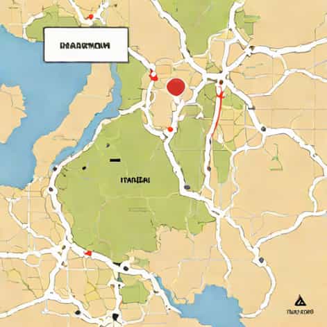
Khartoum is one of the most historically and geographically significant cities in Africa. Known as the capital of Sudan, it sits at a fascinating location where two great rivers meet the Blue Nile and the White Nile. This meeting point gives Khartoum not only its strategic importance but also its unique landscape and cultural influence. When looking at a map, many people wonder exactly where Khartoum is located and what makes its position so special. Understanding its geographical setting helps explain much about the city’s history, economy, and role in the region.
Geographical Location of Khartoum
Khartoum lies in the northeastern part of Africa, in the central-eastern region of Sudan. If you look at a map of Africa, you’ll find Sudan just south of Egypt and bordering the Red Sea to the northeast. Within Sudan, Khartoum is located near the country’s center, slightly toward the east, where the two main branches of the Nile River converge. This location is what gives the city its identity and name Khartoum is believed to derive from an Arabic word meaning elephant trunk, referring to the shape formed by the meeting rivers.
On most maps, Khartoum appears as a point at the junction of the Blue Nile, which flows northwest from Ethiopia, and the White Nile, which flows north from Uganda through South Sudan. The two rivers merge in Khartoum to form the main Nile, which continues northward through Egypt and eventually into the Mediterranean Sea. The exact coordinates of Khartoum are approximately 15.5007° N latitude and 32.5599° E longitude.
Khartoum’s Position in Relation to Other Cities and Landmarks
When viewed on a map, Khartoum lies roughly halfway between the equator and the Mediterranean Sea. It’s about 1,200 kilometers (745 miles) south of Cairo, Egypt, and around 1,600 kilometers (995 miles) northeast of Juba, the capital of South Sudan. To the east of Khartoum lies the Ethiopian border, which is a few hundred kilometers away. The Red Sea coast, another key geographical feature of Sudan, is located about 650 kilometers (400 miles) to the northeast of Khartoum.
The city is also connected to two neighboring towns, Omdurman and Khartoum North (Bahri), which together form the Three Towns metropolitan area. This large urban region is one of the biggest population centers in northeastern Africa and serves as the political, economic, and cultural heart of Sudan.
The Importance of Khartoum’s Location on the Map
Khartoum’s location has always been one of its greatest strengths. Being at the confluence of two major rivers gives the city access to fertile soil, transportation routes, and trade opportunities. Historically, this made it a natural center for commerce and governance. The Blue Nile brings water and resources from the Ethiopian highlands, while the White Nile carries them from the central regions of Africa. The joining of these rivers in Khartoum has made the city a symbolic and literal connection point between different regions of the continent.
Moreover, Khartoum’s central position allows it to act as a gateway between North Africa and Sub-Saharan Africa. It connects the Arab world with the African interior, both culturally and geographically. Because of this, the city has long been a crossroads of languages, religions, and traditions.
Climate and Geography Around Khartoum
The geography around Khartoum is characterized by flat plains and desert landscapes. The city lies within the semi-arid zone of the Sahara, meaning it experiences very hot temperatures for much of the year. Despite the proximity of the Nile, rainfall is limited and mostly occurs between June and September during the short rainy season. The rest of the year is dry, with bright skies and high temperatures that can exceed 40°C (104°F) during the summer.
Looking at a physical map of the region, you would notice that the surrounding area lacks significant elevation or mountain ranges. The terrain is mostly low and flat, which allows the Nile to flow smoothly northward. The presence of the two rivers, however, creates narrow strips of green land that stand out against the golden tones of the desert. These fertile zones are essential for agriculture and have supported human settlements in the area for centuries.
Khartoum on the African Map
If you zoom out to see the African continent as a whole, Khartoum lies in the northeastern quadrant of Africa. It is roughly midway between the Red Sea to the east and the border with Chad to the west. Its position makes it a central hub for transportation and trade routes crossing from east to west and north to south.
From a geopolitical perspective, Khartoum also plays a vital role because it sits near key regional partners. The city is connected by road and air to major African and Middle Eastern capitals, such as Cairo, Addis Ababa, and Riyadh. This strategic placement has influenced Sudan’s relationships with its neighbors and its role in international affairs.
Neighboring Regions and Natural Features
Surrounding Khartoum are several important regions and features that add to its geographical significance. To the north lies the vast Nubian Desert, stretching toward northern Sudan and Egypt. To the south, the land becomes greener and gradually transitions toward the savannas of central Africa. East of Khartoum lies the Ethiopian Plateau, where the Blue Nile begins its journey. Westward, the terrain becomes more arid, leading into the semi-desert regions that extend toward Darfur.
The combination of these diverse landscapes makes Khartoum a kind of geographical bridge between deserts, river valleys, and highlands. This diversity also explains why the area has been a meeting point for different peoples and cultures throughout history.
The Confluence of the Blue Nile and White Nile
One of the most striking features you’ll notice when looking at Khartoum on a map is the point where the Blue Nile and White Nile meet. This confluence is a famous natural landmark that defines the city’s geography. The Blue Nile, originating in Lake Tana in Ethiopia, brings about 80% of the water that eventually flows into the Nile River. The White Nile, on the other hand, starts in the Great Lakes region of Africa and flows through South Sudan before reaching Sudan.
In Khartoum, these two mighty rivers join together just north of the city center. From there, the unified Nile River continues its long journey through northern Sudan and Egypt before reaching the Mediterranean Sea. This geographical feature makes Khartoum one of the most recognizable river cities in the world.
Historical and Cultural Context of Khartoum’s Location
Khartoum’s position has shaped much of its history. Because it lies at a natural meeting point, it has long been a center for trade and administration. During the 19th century, it served as a major trading hub under Ottoman-Egyptian rule and later became the capital of Anglo-Egyptian Sudan. Its access to the Nile made it easier for colonial powers to control transportation and resources.
Today, the same geographical advantages continue to support the city’s importance. Khartoum remains the political and economic center of Sudan, housing government institutions, universities, and industries that benefit from its river connections and central location. The city’s multicultural nature also reflects its position at the crossroads of Africa and the Arab world.
Khartoum’s Surrounding Infrastructure and Development
On a modern map, you can see how Khartoum’s development follows the curves of the rivers. Bridges connect the three main sections of the city Khartoum, Omdurman, and Bahri (Khartoum North) making it easy to cross from one side of the Nile to the other. Major highways and rail lines radiate outward from the city, linking it to Port Sudan on the Red Sea, as well as to central and western regions of the country.
Khartoum International Airport, located in the southern part of the city, further emphasizes its role as a transportation hub. The airport connects Sudan with regional and international destinations, making it a key gateway to the country and the broader region.
Locating Khartoum on the Map of Africa
To sum up, Khartoum is located in the heart of Sudan, near the meeting point of the Blue Nile and White Nile rivers. On the map of Africa, it sits in the northeastern part of the continent, bridging North Africa and Sub-Saharan Africa. Its coordinates around 15° north of the equator and 32° east of Greenwich place it in a region rich with history, culture, and strategic significance.
When you look at a map and find the spot where the two Niles merge, you’ve found Khartoum. Its location not only defines the city’s geography but also explains its historical role as a center of trade, politics, and culture. Whether viewed from a global, regional, or local perspective, Khartoum’s place on the map tells the story of a city shaped by rivers, history, and the enduring connection between land and water.