When discussing geography and global positioning, one of the most fundamental concepts to understand is latitude. Among the various latitudinal lines that circle our planet, the Equator stands out as the most significant. It divides the Earth into two equal halves the Northern Hemisphere and the Southern Hemisphere. Understanding what latitude means on the Equator and how it affects climate, navigation, and geography helps us better comprehend the planet’s structure and natural phenomena.
Definition of Latitude
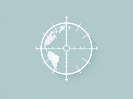
What Is Latitude?
Latitude is a geographic coordinate that specifies the north-south position of a point on the Earth’s surface. Measured in degrees, latitude ranges from 0° at the Equator to 90° at the poles. Lines of latitude are also called parallels because they run parallel to each other and to the Equator. These lines are used in navigation, mapping, and for understanding climate zones across the world.
How Latitude Is Measured
Latitude is measured from the center of the Earth. An angle is drawn between the equatorial plane and a line connecting the point of interest to the Earth’s center. This angular measurement tells us how far north or south a location is from the Equator. North of the Equator, latitude is expressed in degrees north (°N), and south of the Equator, in degrees south (°S).
Latitude on the Equator
Equator’s Exact Latitude
The Equator is defined as the line of 0 degrees latitude. This means that any point directly on the Equator has a latitude of 0°. It is the baseline from which all other lines of latitude are measured. The Equator is a unique circle that lies equidistant from the North and South Poles, making it the widest circumference of the Earth.
- Latitude on the Equator 0°
- Direction Neither north nor south
- Geographical position Divides Earth into two equal halves
Geographical Importance of the Equator
The Equator runs through multiple countries across three continents South America, Africa, and Asia. It passes through countries such as Ecuador, Colombia, Brazil, Gabon, Democratic Republic of the Congo, Kenya, Uganda, and Indonesia. These nations experience relatively consistent day lengths and high solar exposure throughout the year due to their position on the Equator.
Climate on the Equator
High Temperatures and Humidity
Regions on the Equator are known for having tropical climates. Because of the Earth’s tilt and the perpendicular angle of sunlight year-round, equatorial areas receive the most direct solar radiation. As a result, these regions experience high temperatures and consistent daylight throughout the year.
Due to the intense heating, equatorial areas are often humid and have abundant rainfall. This supports the growth of tropical rainforests, such as the Amazon in South America and the Congo Basin in Africa.
Minimal Seasonal Variation
Unlike temperate regions that have four distinct seasons, equatorial zones typically have only two a wet season and a dry season. The minimal variation in daylight and temperature makes equatorial climates some of the most stable on Earth.
Sun Position and Daylight at 0° Latitude
Solar Zenith and Equinoxes
At the Equator, the Sun is directly overhead at noon during the equinoxes, which occur around March 21 and September 23 each year. On these days, the entire Earth experiences equal day and night durations. For equatorial regions, however, the length of day and night remains close to 12 hours throughout the year.
Consistent Sun Angle
Because the Sun’s angle changes very little over the course of the year at the Equator, the amount of solar energy remains relatively constant. This results in consistent weather patterns and contributes to the biodiversity found in equatorial ecosystems.
Human and Natural Impact of Equatorial Latitude
Dense Vegetation and Agriculture
The fertile land and consistent rainfall in equatorial zones make them ideal for agriculture, especially crops like bananas, cocoa, coffee, and sugarcane. However, the same conditions can also lead to challenges such as plant diseases and soil degradation due to excessive rainfall.
Tropical rainforests on the Equator are rich in biodiversity. These forests play a crucial role in regulating global climate by absorbing carbon dioxide and producing oxygen. However, they are under threat due to deforestation and human expansion.
Population Distribution and Urban Centers
While some equatorial regions are sparsely populated due to dense forests or rough terrain, others have significant urban populations. Cities such as Quito in Ecuador and Kampala in Uganda are located very close to the Equator. People living in these areas often adapt their lifestyles to the high humidity and warm temperatures typical of equatorial climates.
Navigation and the Equator
Importance in Global Mapping
Because latitude begins at the Equator, it plays a central role in cartography and navigation. All other lines of latitude are defined in relation to the 0° mark. The Equator also serves as a reference point for GPS systems, aviation, and maritime travel.
Equatorial Bulge
Due to the rotation of the Earth, the planet bulges slightly at the Equator. This equatorial bulge means that the Earth’s diameter is wider at the Equator than at the poles. As a result, objects at the Equator are slightly farther from the Earth’s center than objects at higher latitudes.
This bulge has minor but important effects on gravitational force and satellite orbits. Satellites launched into orbit often use an equatorial trajectory to take advantage of the Earth’s rotational speed.
Unique Phenomena at the Equator
Coriolis Effect and Weather Systems
The Coriolis effect is weakest at the Equator, causing unique behavior in wind and ocean currents. For example, cyclones and hurricanes do not typically form directly at the Equator because the Coriolis force is too weak to initiate the rotational motion needed to develop such storms.
Water Drainage Myth
There is a common myth that water drains in opposite directions in the northern and southern hemispheres, and that this effect is visible at the Equator. While the Coriolis effect does influence large systems like storms, it does not determine the direction water spins in a sink or toilet. That effect is usually caused by the shape of the basin and initial water motion, not latitude.
Countries Located on the Equator
List of Equatorial Nations
- Ecuador
- Colombia
- Brazil
- Gabon
- Democratic Republic of the Congo
- Republic of the Congo
- Uganda
- Kenya
- Somalia
- Indonesia
- São Tomé and PrÃncipe
These countries share the unique geographic distinction of being crossed by the 0° latitude line. Their locations make them ideal for equatorial research stations, space launch sites, and biodiversity studies.
On the Equator, the latitude is exactly 0°, serving as the foundation for measuring geographic coordinates north and south across the globe. This imaginary line is not just a theoretical concept it shapes climate patterns, ecosystems, human lifestyles, and navigation systems. The unique characteristics of equatorial regions, including consistent daylight, tropical climates, and high biodiversity, make them some of the most fascinating places on Earth. Understanding the role of the Equator and its precise latitude helps us better appreciate our planet’s geography and interconnected systems.