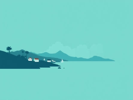
Nestled along a deep natural harbor on the Caribbean Sea, Castries is the capital and largest city of Saint Lucia, a lush island nation in the eastern Caribbean. Known for its vibrant markets, colonial history, and picturesque coastal views, Castries holds an important place both geographically and culturally within the Caribbean region. For travelers, researchers, or anyone curious about Caribbean geography, understanding where Castries is located offers insight into the strategic and scenic value of this island capital.
Geographical Location of Castries
Position in the Caribbean
Castries is located in the eastern Caribbean Sea, on the northwest coast of Saint Lucia. Saint Lucia is part of the Lesser Antilles island chain, specifically within the Windward Islands. These islands form the eastern boundary of the Caribbean Sea and the western boundary of the Atlantic Ocean, making this region a maritime crossroads.
Saint Lucia lies to the north of Saint Vincent and the Grenadines and to the south of Martinique. Castries, the capital, sits in a sheltered bay known as Castries Harbor, which is one of the most important deep-water ports in the Eastern Caribbean. Its coordinates are approximately 14.01° N latitude and 60.99° W longitude.
Proximity to Other Caribbean Locations
On a regional map, Castries is not far from many other Caribbean capitals and islands
- About 40 km (25 miles) south of Fort-de-France, Martinique
- Roughly 120 km (75 miles) north of Kingstown, Saint Vincent
- Approximately 150 km (93 miles) northwest of Bridgetown, Barbados
This central position makes Castries a common stop for cruise ships and regional flights, enhancing its significance in Caribbean travel and commerce.
Castries in the Context of Saint Lucia
Administrative Role
Castries serves as the administrative, political, and economic center of Saint Lucia. It is home to key government institutions, including the official residence of the Governor-General, the Parliament, and numerous ministries. This makes it not only the largest urban area on the island but also the heart of decision-making and governance.
Population and Urban Structure
Castries has an estimated population of around 20,000 residents in the city proper, with the surrounding district housing a much larger portion of Saint Lucia’s total population. The city is a blend of urban development, colonial-era architecture, and modern infrastructure. Castries has grown outward from its original harbor location, forming a crescent shape along the bay and stretching into surrounding hills and neighborhoods.
Main Features of the City
Important landmarks and districts within Castries include
- Derek Walcott Square– A central plaza named after the Nobel Prize-winning poet from Saint Lucia.
- Cathedral of the Immaculate Conception– The largest church in the Caribbean, located near the square.
- Vigie Peninsula– Home to Vigie Beach and George F. L. Charles Airport.
- La Toc– A neighborhood with historic forts and scenic views of the coastline.
Economic Importance of Castries
Port and Trade
Castries Harbor is a key maritime gateway for Saint Lucia. Its naturally deep port accommodates large commercial ships and cruise liners. Export goods such as bananas and cocoa once played a larger role in the economy, but today, tourism and services dominate the city’s financial activity. The harbor also supports local fishing and inter-island transport.
Tourism Hub
Castries is a popular destination for Caribbean cruises, with many ships docking directly in the city center. From there, visitors often explore local markets, take scenic drives to nearby beaches, or travel to other parts of the island. The presence of duty-free shopping, craft markets, and historical landmarks makes Castries a cultural highlight for tourists.
Business and Infrastructure
The capital hosts numerous banks, hotels, government buildings, and international offices. Financial services and offshore banking also contribute to the local economy. Castries benefits from road networks that connect it to other parts of Saint Lucia, including the major tourism regions of Rodney Bay and Soufrière.
Historical Background and Influence
Colonial History
The city of Castries has a rich and complex history influenced by both French and British colonial powers. Founded by the French in the 17th century, Castries was named after Charles Eugène Gabriel de La Croix, Marquis de Castries. Control of Saint Lucia shifted several times between the French and British before the island finally became a British colony.
This dual colonial history has left a cultural imprint that is still visible today in the architecture, language, and traditions of Castries. English is the official language, but French-based Creole is widely spoken among locals.
Modern Development
Castries has experienced significant redevelopment over the years, especially following major fires and hurricanes that damaged parts of the city. While modernization has introduced new buildings and roadways, many historic elements have been preserved, creating a unique blend of old and new within the capital.
Transportation and Accessibility
Getting to Castries
Visitors typically arrive in Castries via air or sea. The city is served by George F. L. Charles Airport (SLU), located just north of the city center, which handles regional flights from nearby islands. The larger Hewanorra International Airport (UVF), located in the south of Saint Lucia, connects the island to international destinations and is about 90 minutes by car from Castries.
Transportation Within the Island
Castries is connected by road to all major areas of Saint Lucia. Public minibuses, taxis, and car rentals make travel around the island accessible. Water taxis and ferry services are also used for coastal travel, particularly between tourism hubs.
Cultural and Social Significance
Festivals and Events
Castries plays host to many of Saint Lucia’s national celebrations. Carnival parades, independence day events, and music festivals often take place on its streets and public squares. The city reflects the vibrant Caribbean culture of Saint Lucia, featuring a mix of music, dance, food, and storytelling traditions.
Local Life and Identity
Castries represents the social heartbeat of Saint Lucia. It is where many people live, work, study, and engage in cultural activities. Street vendors selling tropical fruits, school children in uniform, and fishermen returning with the day’s catch are common scenes that illustrate the daily life of this island capital.
Castries is located on the northwest coast of Saint Lucia in the Eastern Caribbean and serves as the island’s capital city. Its geographic position in the Windward Islands places it within reach of many neighboring countries, and its harbor plays a vital role in tourism and trade. As a cultural, economic, and political center, Castries offers insight into the spirit of Saint Lucia and its place in the wider Caribbean region. Whether viewed on a map or visited in person, Castries stands out as a vibrant and essential city in the Caribbean landscape.