Set in the French Alps near the Italian border, Serre Chevalier is one of the largest ski resorts in Europe and a favorite among skiers and snowboarders from around the world. Whether you’re a beginner discovering the joy of skiing or an advanced rider looking for a challenge, understanding the piste map of Serre Chevalier is essential for making the most of your trip. The resort offers a wide variety of ski runs, from gentle nursery slopes to steep black runs, all connected by a network of modern lifts and scenic mountain paths. The piste map helps visitors plan routes, locate amenities, and navigate between the different sectors of this expansive resort.
Understanding the Layout of Serre Chevalier
Serre Chevalier Vallée covers a vast area stretching over 250 kilometers of slopes, linking four main villages: Briançon, Chantemerle, Villeneuve, and Le Monêtier-les-Bains. The ski domain spans elevations from 1,200 meters to 2,800 meters, providing reliable snow cover and varied terrain. Each village has its own base area, offering direct access to the lifts and slopes, as shown on the piste map.
Main Sectors in the Piste Map
The Serre Chevalier piste map is divided into several sectors, each offering unique terrain and experiences. Understanding these sectors helps skiers and snowboarders choose the best areas for their skill level and preferences.
- Briançon: The historic town with charming architecture and a base area offering access to scenic intermediate runs.
- Chantemerle: Also known as Serre Chevalier 1350, this village offers access to classic red and blue runs like the popular Luc Alphand piste.
- Villeneuve: Centrally located and one of the busiest areas, perfect for families and intermediate skiers with varied terrain.
- Le Monêtier-les-Bains: The highest village with access to high-altitude skiing and thermal baths for après-ski relaxation.
The piste map clearly displays how lifts and ski runs connect these villages, making it easy to plan full-day ski excursions across the entire valley.
Types of Runs on the Piste Map
Serre Chevalier’s piste map features color-coded runs to indicate difficulty, a standard used across most European ski resorts:
- Green: Beginner slopes, ideal for learning the basics in a safe, gentle environment.
- Blue: Easy runs for those gaining confidence or looking for a relaxing descent.
- Red: Intermediate pistes that provide longer and slightly steeper challenges.
- Black: Advanced slopes with steep sections and variable conditions, suitable for experienced skiers.
Most runs are accessible from multiple lifts, and the piste map includes the names and types of each lift to help you choose the most efficient routes.
Popular Runs Highlighted on the Map
Some runs stand out on the Serre Chevalier piste map due to their popularity, history, or natural beauty. Here are a few must-try pistes:
- Luc Alphand (Red): A legendary run named after the French skiing champion, descending from the top of Chantemerle to the village.
- Casse du BÅuf (Black): A thrilling black piste located in the Villeneuve sector, known for its steep gradient and fast conditions.
- La Cucumelle (Blue): Offers a long and scenic descent into Le Monêtier-les-Bains with breathtaking alpine views.
- Les Vallons: A freeride area marked for experienced skiers looking for off-piste adventure, marked on the map with special signage.
These featured runs are easily located on the piste map, often marked with special symbols or highlighted names for visitor convenience.
Ski Lifts and Accessibility
The Serre Chevalier piste map includes detailed information on the lift system, which includes over 60 lifts consisting of:
- Gondolas
- Chairlifts (detachable and fixed)
- Drag lifts (button lifts and rope tows)
Major gondolas like the Prorel, Ratier, and Fréjus lifts connect lower villages to high alpine terrain. The map indicates lift types and their capacity, helping visitors make informed decisions during peak hours or when moving quickly across the resort.
Snowparks and Fun Zones
For snowboarders and freestyle skiers, the Serre Chevalier piste map highlights designated snowparks and fun zones. The main snowpark is located in the Villeneuve area and includes features such as:
- Kickers and jumps for various skill levels
- Rails and boxes
- Boardercross track for racing with friends
These areas are clearly marked on the map and have nearby lifts for easy access and repeated runs.
Beginner Areas and Family-Friendly Zones
Families visiting Serre Chevalier will find several beginner zones marked on the piste map, including Espace Débutant areas with magic carpets and gentle slopes. Some of the best beginner zones are located near the base of Chantemerle and Villeneuve, offering safe environments for children and first-timers. These areas often include ski schools and instructors nearby, also indicated on the map.
Mountain Restaurants and Rest Stops
The piste map also features mountain restaurants and huts where skiers can stop for a meal or rest. Some of the popular eateries include:
- Le Chalet Hôtel Serre Ratier: Mid-mountain dining with panoramic views.
- Pi Maï Restaurant: Near the slopes in Villeneuve with traditional alpine cuisine.
- L’Alpage: Accessible via green and blue runs, offering local food and warm ambiance.
Locations are marked on the piste map, making it easier to plan lunch stops during a day on the slopes.
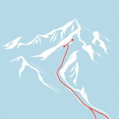
Off-Piste and Ski Touring Routes
Adventurous skiers looking to explore beyond the groomed pistes can use the map to locate off-piste zones and ski touring routes. These areas are typically marked with dashed lines or icons and should only be accessed with proper gear and knowledge of avalanche safety. The northern face of Le Grand Aréa and backcountry terrain near Monêtier are popular choices among advanced skiers.
Using the Piste Map Effectively
To fully benefit from the piste map, consider these tips:
- Always carry a physical copy of the map, especially if mobile signal is limited.
- Study the map each morning to plan routes based on skill level and lift opening times.
- Look for the nearest lift in case of changing weather conditions.
- Use the map to locate safety points and ski patrol stations.
Many hotels and ski rental shops offer free maps, and updated versions are available at lift stations and online for download before your trip.
The piste map of Serre Chevalier is more than just a guide it’s your key to exploring one of the most dynamic ski areas in the French Alps. With hundreds of kilometers of slopes, a variety of terrain for all skill levels, and clear connections between charming alpine villages, the map helps you unlock a world of skiing opportunities. Whether you’re carving down red runs, enjoying a family day on the greens, or exploring freeride terrain, knowing how to read and use the piste map ensures a safe, enjoyable, and unforgettable alpine adventure.
“`